Data partner for municipalities and provinces
Data-driven software, current asset data and data analysis for managing public space.
- Location driven
- project management
- 1 source
- for drawing, permit and invoice
- PDOK / BGT
- national data connected automatically
- < 1 workday
- response time on your question
What fits your situation
Tell us briefly who you are and what you're dealing with. We'll point you the right way.
Software already running in infrastructure projects
No slideware: four in-house platforms used daily by road authorities, contractors, designers and traffic engineers.
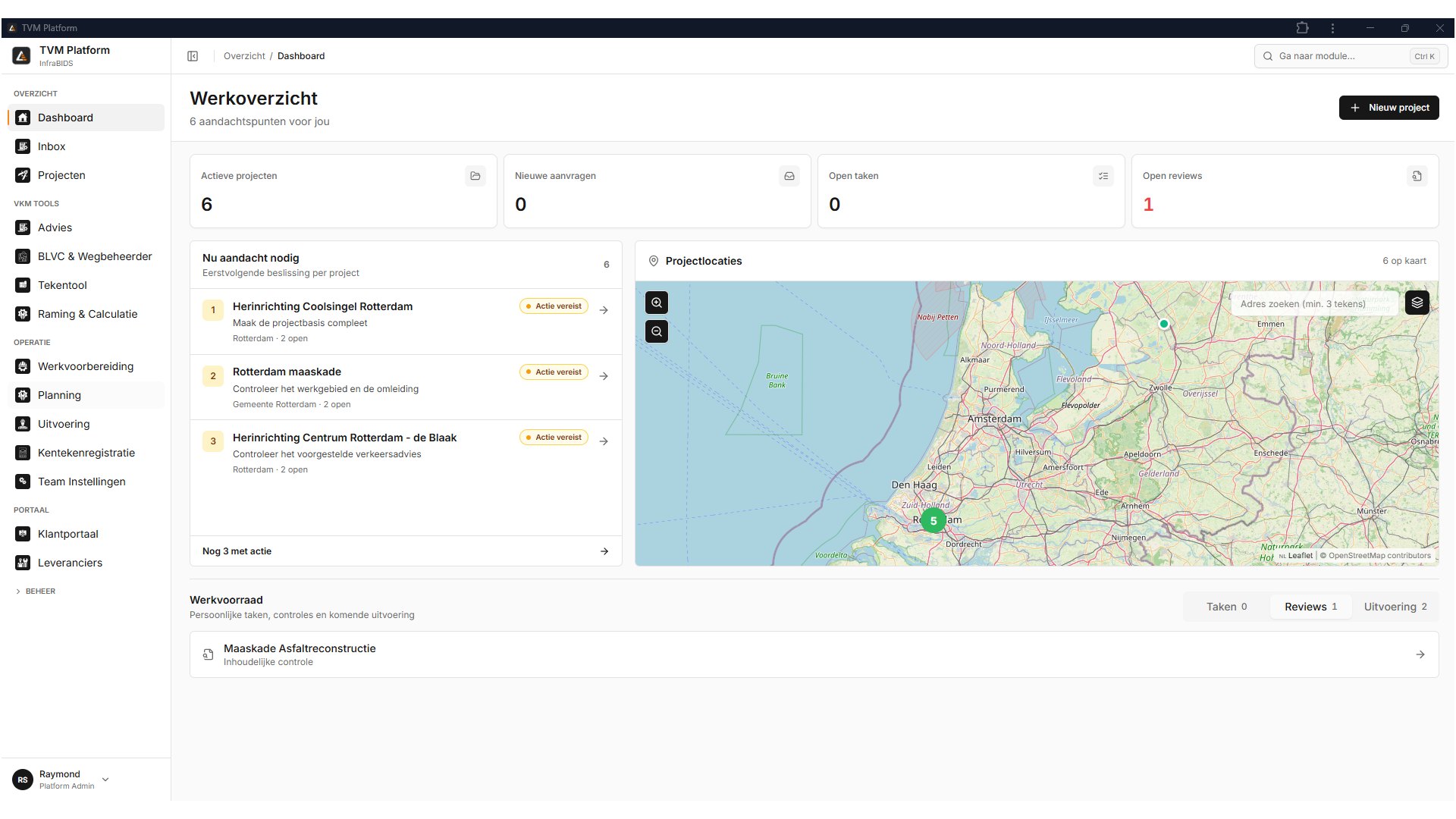
TVM Operating System
One digital project twin for temporary traffic measures
From intake, BLVC advice and permits to traffic plans, material lists, planning, execution, as-built and invoicing, all on the same project twin, without retyping between systems.
- Semantic TVM objects on national base maps, with a live material list
- Work zones, phasing and diversions automatically linked to street names
- Preflight checks on the traffic plan before submission
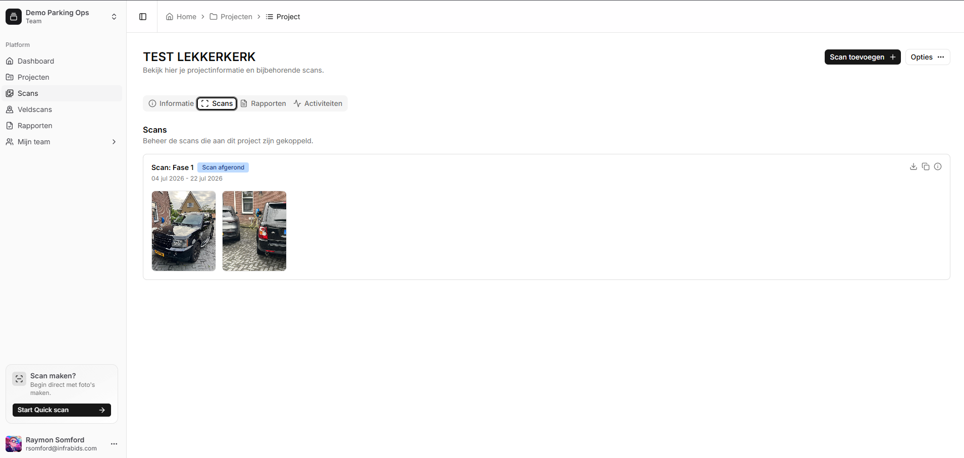
Infrafoto
Licence plate registration for temporary traffic measures
Taking a photo is registration. Infrafoto reads licence plates via OCR, fetches RDW data, logs GPS location and timestamp, and generates a registration list or PDF in the road authority's format.
- Automatic licence plate recognition (OCR) with correction flow
- Geolocation, timestamp and RDW data per registration
- Project-based workflow: registrations per phase and location
- Registration list or PDF in the required format
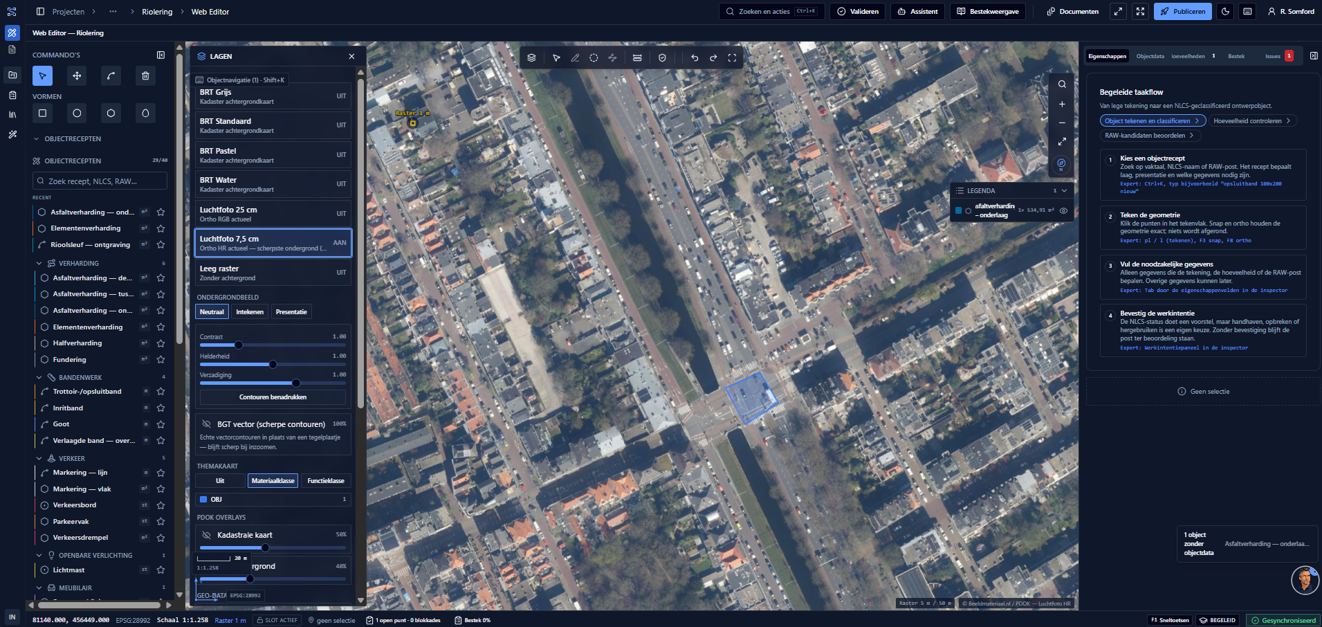
BestekStudio
Object-driven 2D GeoCAD in the browser, specification-ready
Draw civil objects in RD New (EPSG:28992) on national base maps or aerial imagery with sharp BGT vector outlines. Every object immediately yields quantities, NLCS layers and candidate RAW bill items, with a guided flow from empty drawing to classified design object.
- Object recipes for paving, kerbs, traffic, lighting and street furniture
- Guided flow: draw, classify, check quantities, review RAW candidates
- Base maps of your choice: topography, 7.5 cm aerial imagery, cadastral map and BGT vector outlines
- Deterministic quantities with version, hash and quality state
- Validation rules, an issue list and immutable revisions per publication
InfraBIDShare
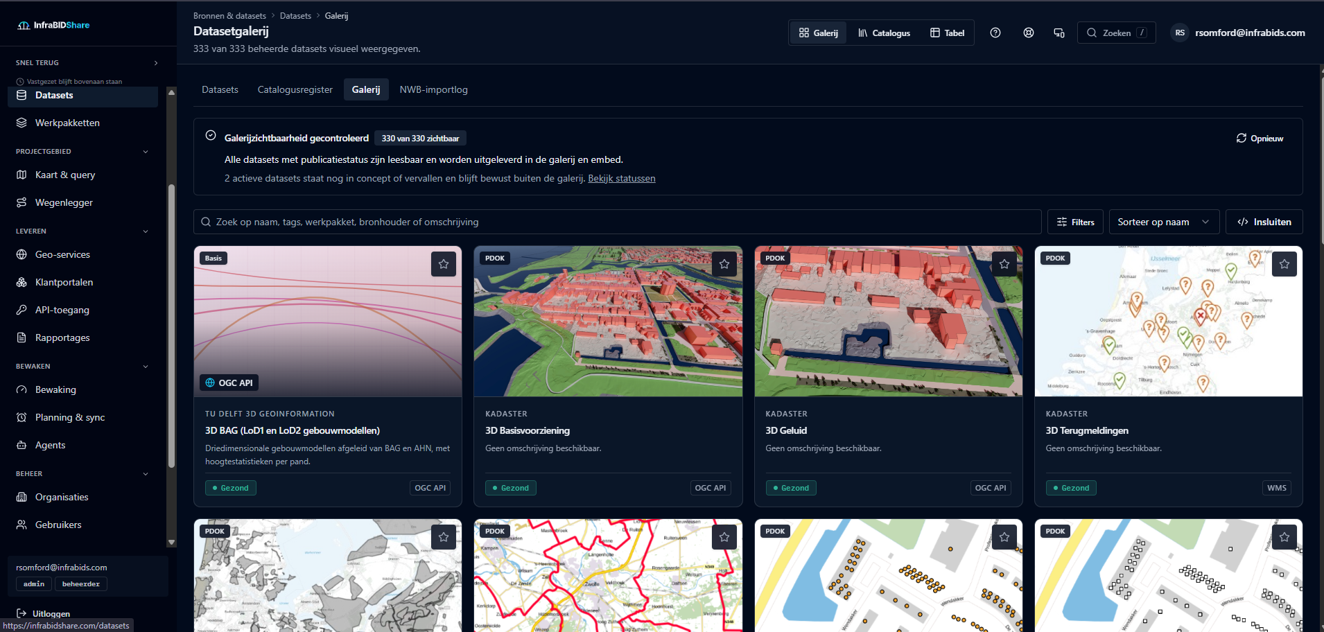
Manage geospatial data and the road register in one place
InfraBIDShare combines open sources such as NWB, BGT and BAG with your own management layers. You monitor the sources, check quality, build the road register and deliver everything through APIs, embeds and OGC services.
- Dataset register with metadata, quality status, sensitivity and agreements on AI use
- Source monitoring on WFS, WMS and REST: response times, outages and expired limits
- Road register with source and confidence per field; uncertain fields become decisions in the work list
- Map selection, QGIS and Python processing and export to GeoJSON, GeoPackage, shapefile or KMZ
- Delivery through a REST API, embeds, vector tiles, WFS and WMTS
See what we can do with data
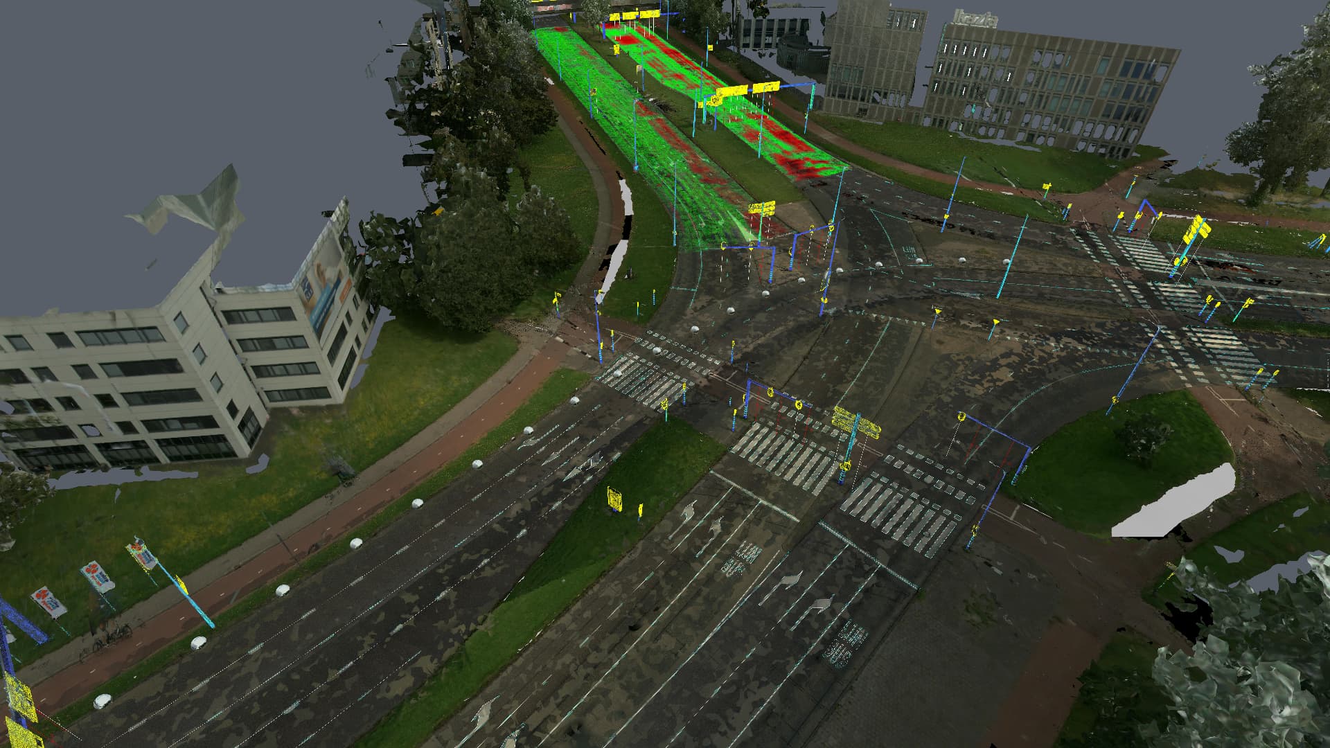
Real data examples from practice: point clouds, meshes and visualisations you can rotate, zoom and measure in the browser. No plug-ins, no installation, a preview of the information our software and models unlock.
InfraBIDS data example
Intersection & road section · Mesh + point cloud
Intersection & road section
Fully surveyed intersection with lane layout, markings and signage, directly measurable in metric units.
Drag to rotate, scroll to zoom. Measurements in meters.
On first visit the 3D environment shows a one-time cookie notice from the underlying geocloud. Choose "Accept All Cookies" there, your browser remembers it and the notice won't return. We don't place tracking cookies through the data example ourselves.
We remember your viewer and cookie preferences on this device, so the scene opens right away on your next visit.
Want to see what your own data could deliver?
Book a demo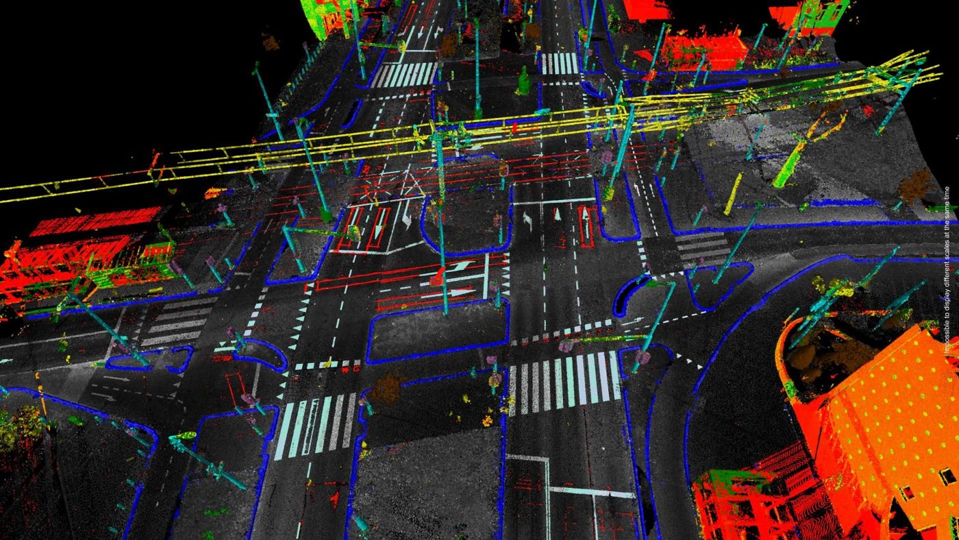
Engineers who build data software
InfraBIDS is a Dutch firm that combines hands-on civil engineering practice with software development and data science. We know the work on site as well as the code that can replace it.
We work for contractors, engineering firms and public authorities: designing digital tools, automating data processing and turning geo data, traffic data, imagery and project files into information people can actually use. We don't sell scans; we make software that makes scans and other data work.
The people behind InfraBIDS.
InfraBIDS was founded by Raymon Somford and Tim Eikelenboom. Bringing our fields of expertise together creates an unusual mix: deep domain knowledge of infrastructure and execution, combined with software engineering and data science. That is why we speak the language of a road authority as easily as that of a data team, and deliver solutions that hold up in practice.

Raymon Somford
Co-captain, infrastructure domain knowledge & product
Raymon is a director of InfraBIDS and previously built RISE3D, was Regional Director at BUKO, where the foundation for the InfraBIDS technology and the TVM platform was laid. He brings 20+ years of hands-on infrastructure and surveying experience and translates it into workable digital processes for clients, contractors and road authorities.

Tim Eikelenboom
Co-captain, data science & software
Tim studied Psychology (statistics) (Erasmus University Rotterdam) and Data Science & Society (Tilburg University) and previously worked as an analyst and Lead Data Science. At InfraBIDS he leads data science and software development: from machine learning on point clouds and imagery to the data platforms and dashboards clients steer on.
What we can take off your hands
From first exploration to a running system: we deliver the software, analytics and data processing infrastructure projects rely on every day.
We train models that automatically detect objects, damage, traffic behaviour and risks, so you spend less time manually checking and measuring.
We build custom platforms, integrations and dashboards that fit your processes and data sources.
We combine PDOK, BGT, internal datasets and external geo data into one consistent information source for your applications.
You handle temporary traffic measures from intake to as-built in one flow, including safety plans, permits and material lists.
You get advice from people who know the work: which data flows and software steps deliver the most value in your project.
We unlock project data from different sources into one dashboard, so you steer on facts instead of gut feeling.
Work we built ourselves
No second-hand references: these are projects we delivered, with the software and analytics that came out of them.
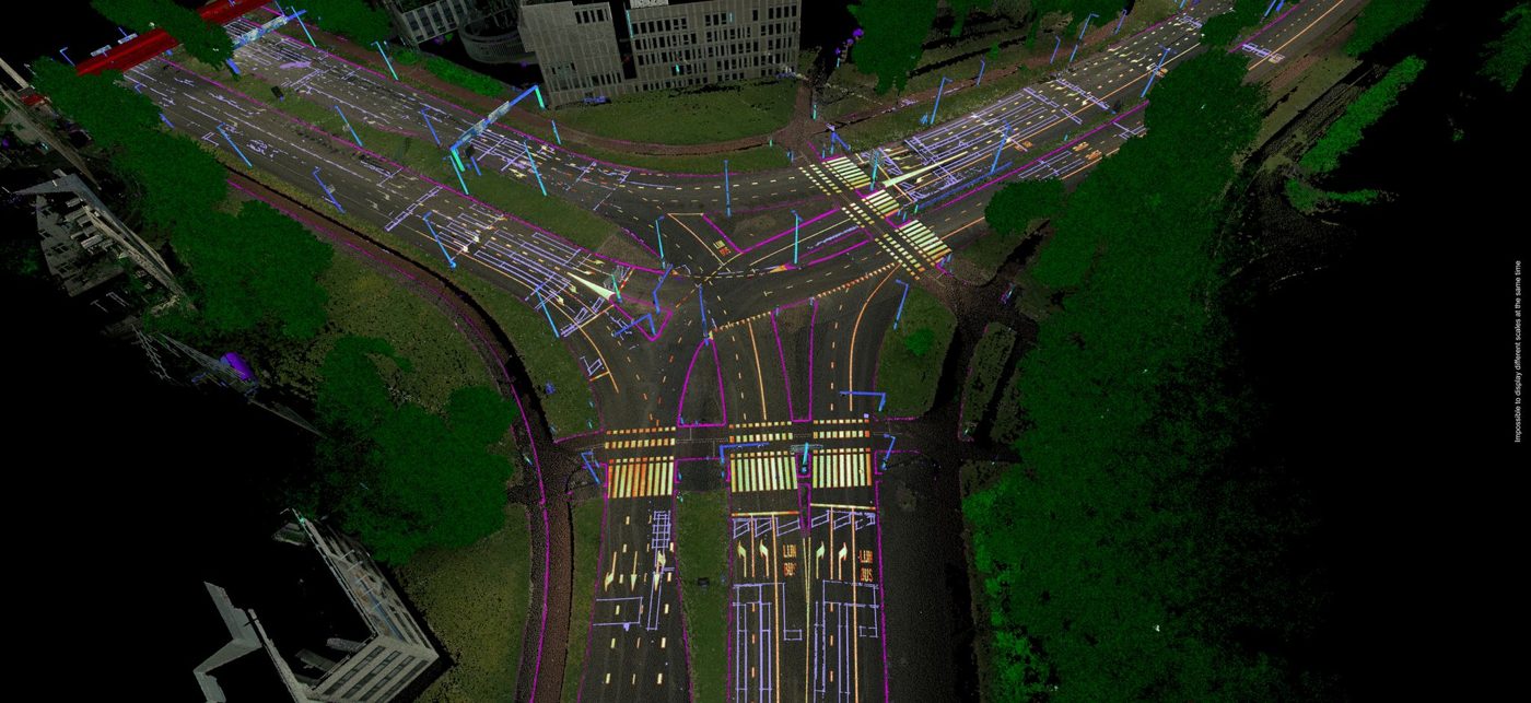
For: Road and asset managers
Mobile geo data and imagery are turned into classified assets with machine learning: signs, markings, guardrails, gullies and trees, including location and condition.
What it delivers: Inventory without manual digitising, ready for the asset management system.
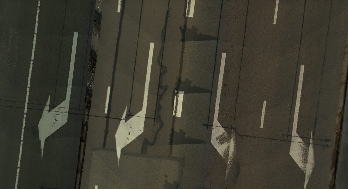
For: Contractors and inspection teams
We develop models that detect and measure damage, markings, evenness and other objects from geo data and imagery, so you assess from your desk and only go on site when it matters.
What it delivers: Less field work, more consistent assessment and faster reporting.
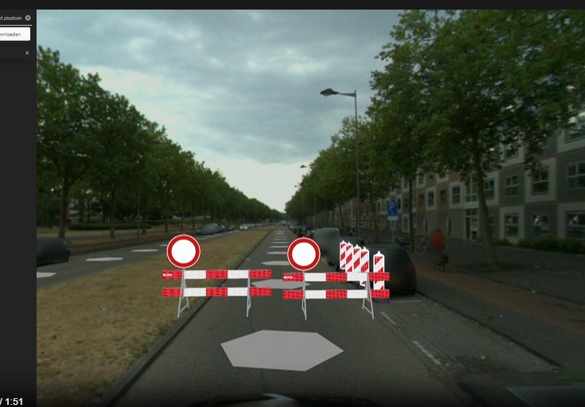
For: Traffic engineers and permit authorities
One software platform tying together intake, BLVC, permits, traffic plans, material lists, planning and as-built, built around a digital project twin.
What it delivers: No more retyping between drawing, application, calculation and invoice.
Infrafoto, licence plate registration & RDW enrichment
Our web app for parking ban registration: OCR reads licence plates, RDW data is fetched automatically, and reports are generated per project.
Built for tendering, asset management and delivery teams.
Infrastructure clients don't buy demos, they buy certainty. These are the things you can hold us to.
- in-house platforms in production
- 4in-house platforms in production
- true-ortho road imagery resolution
- 5 mmtrue-ortho road imagery resolution
- public demos and datasets
- 30+public demos and datasets
- business day response time
- < 1business day response time
Proven in production
Four in-house platforms (TVM Operating System, Infrafoto, BestekStudio and InfraBIDShare) run live in real projects, not in a pilot sandbox.
Open standards
We work with the sector's standards: BRT/BGT, RAW, IMBOR, NLCS, CB-NL, GeoJSON and WFS/WMS. Your data stays yours.
GDPR & hosting in the Netherlands
Data is processed and stored inside the EU, with a data processing agreement, role-based access and logging.
Domain knowledge plus data science
Traffic and geo practitioners at the table, combined with machine learning, computer vision and 3D data processing.
Standards and formats we work with
This is what our work looks like
Data examples from practice: visualisations, analyses, dashboards and the field work behind the data.
Frequently asked questions about InfraBIDS
Answers to the questions clients, contractors and governments ask us most.
What exactly does InfraBIDS do?
InfraBIDS is a data-driven software company. We build data platforms, custom software, GIS solutions and machine-learning models for construction, governments and infrastructure. We do not sell scans; we make software that makes existing data, geospatial data, imagery, traffic data and project files, work.
Which organisations does InfraBIDS work with?
We work with contractors, engineering firms, utility operators, municipalities, provinces and national agencies in the Netherlands that deliver or supervise infrastructure and mobility projects.
What is the TVM Operating System?
The TVM Operating System is our integrated software platform built around a digital project twin: a single source for intake, advice, BLVC, permits, drawings, cost calculation, quotation, planning, execution, as-built, handover and invoicing.
Do you integrate with existing systems and data?
Yes. We connect to existing sources such as GIS, BIM, IoT sensors, traffic data and ERP systems, so there is no duplicate data entry and existing investments keep paying off.
How does a project start and how fast can we begin?
We start with a short intake in a Teams meeting, then deliver a concrete proposal with scope and timeline, and work in short iterations with working software. A first usable result is typically available within a few weeks.
How do you handle privacy and data security?
Data is processed within the EU under GDPR, with clear agreements on ownership, access and retention. Where required we sign a data processing agreement.
What does a data platform or custom software project cost?
Most engagements start with a scoped pilot of a few weeks for a fixed fee. After that we work per sprint or at a fixed price per module. You always receive a proposal with scope, timeline and investment up front, so there is no open ending.
What is Infrafoto and how does it relate to the TVM platform?
Infrafoto is our platform for licence plate registration and field observations around temporary traffic measures. It delivers structured registrations, with location, timestamp, RDW data and photo, that the TVM Operating System uses for execution, evidence and public space management.
Which geospatial data and standards do you support?
We work with point clouds (LAS/LAZ), meshes, orthophotos, GeoPackage, Shapefile, WFS/WMS and 3D tiles, and deliver according to Dutch standards such as BGT, IMBOR, IMKL and the RAW specification system. We unlock and interpret this data in software; we are not a data capture company ourselves.
Can you carry out inspections and data capture yourselves?
No, that is not our core. We build software and models that interpret, classify and geometrically analyse geospatial data, imagery and sensor data. We can facilitate data capture or unlock existing datasets from clients and partners. Our strength is converting that raw data into usable information and decision support.
Where is our data stored?
All data is stored and processed within the European Union, with encryption in transit and at rest, role-based access and documented retention periods. You remain the owner of your data.
How can I get in touch with InfraBIDS?
Book a Teams meeting via the form on this page or email info@infrabids.com. You receive an automatic confirmation and we usually reply within one business day.
Talk to Piet: in the chat or from your own AI agent
Our site knowledge is available in two ways: through Piet, our digital colleague in the corner, and through a secured MCP server you connect to Claude, ChatGPT, Cursor or Codex.
Piet spots what you miss
Piet thinks along about services, platforms, team and way of working, points you to the right page and books a Teams meeting right inside the chat.
MCP server for agents
Nine tools: question answering across all site content, capability matching per audience, in-depth cases, company profile, services, projects, team, search and meeting requests, secured with OAuth 2.1.
Always the current source
Chat and MCP read the same content source as the website, so answers never lag behind what is published.
MCP endpoint
https://infrabidsite.com/mcp
Tell us what's going on in your project
A data problem, custom software or a traffic question: put it to us and you get a concrete answer, not a sales pitch.
Takes 30 minutes. You get an email confirmation right away.